-
Notifications
You must be signed in to change notification settings - Fork 9
Inputs
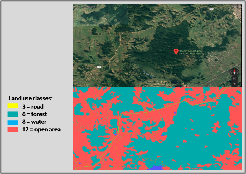
LSMetrics input maps can be binary maps or non-binary land use maps. Binary maps contain "1" and "0" values; "1" represent a kind of habitat or land use of interest, while "0" represents all other land use classes. Non-binary maps can include different land use classes, such as different types of forests and matrices (pasture, plantations, highways). Each class is then assigned a integer code. For example, in the map shown below forest pixels have code "6", pastures are "12", water equals "8", and roads equals "3". The user must to define the codes of each class of the land use map using GRASS GIS or any other GIS software, so that they can select the codes of their interest in LSMetrics.
See in the figure below a land use raster representation with several classes, using as example a location in Rio de Janeiro, near the Poço das Antas Biological Reserve.

Note that the codes are showed as integers. See the main codes meaning below, in comparison with a satellite image for the same area:

The LS metrics repository also contains a map with land use classes in the municipality of Rio Claro, for testing purposes. We used the Rio Claro map to run the examples of metrics in the Output links.
Satellite images can be classified by image interpretation or automatic classification algorithms (supervised or unsupervised). If you still need to map your study area, consider the following auxiliary readings and video:
There are many alternatives of land use maps and binary maps for different geographic regions. Take a look at some examples:
As LSMetrics uses meters and hectares the default units for calculating distances and areas, raster input maps must be exported in a metric coordinate reference system (CRS), such as Albers or UTM coordinate systems. Please, check the next sessions on creating a GRASS Location and be sure about your working EPSG code.
