-
Notifications
You must be signed in to change notification settings - Fork 3
6_Satellite Models
These models have been made for the CoastSeg package for Landsat and Sentinel-2 imagery. Imagery must be in 8-bit jpeg format.
- A dataset of high resolution (cm - m) oblique aerial imagery, labeled according to the following classes:
- Water
- Other
- dataset: https://zenodo.org/record/7384242#.Y_flBoDMLRY
- dataset citation: Buscombe, Daniel. (2022). Images and 2-class labels for semantic segmentation of Sentinel-2 and Landsat RGB satellite images of coasts (water, other) (v1.0) [Data set]. Zenodo. https://doi.org/10.5281/zenodo.7384242


- Zenodo release: https://zenodo.org/record/7448405
- model citation: Buscombe, Daniel. (2022). Doodleverse/Segmentation Zoo Res-UNet models for 2-class (water, other) segmentation of Sentinel-2 and Landsat-7/8 3-band (RGB) images of coasts. (v1.0) [Data set]. Zenodo. https://doi.org/10.5281/zenodo.7448405
- segmentation zoo model name:
sat_RGB_2class_7448405
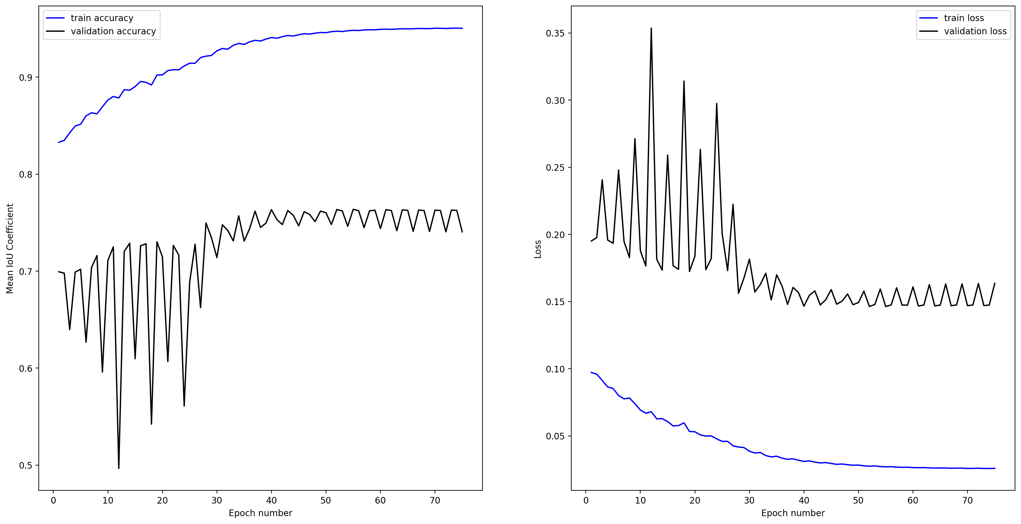
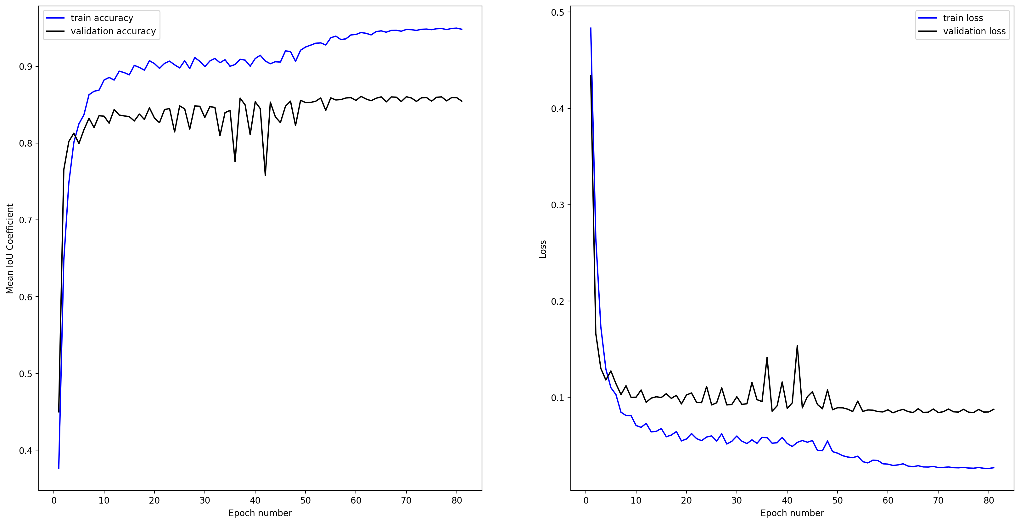
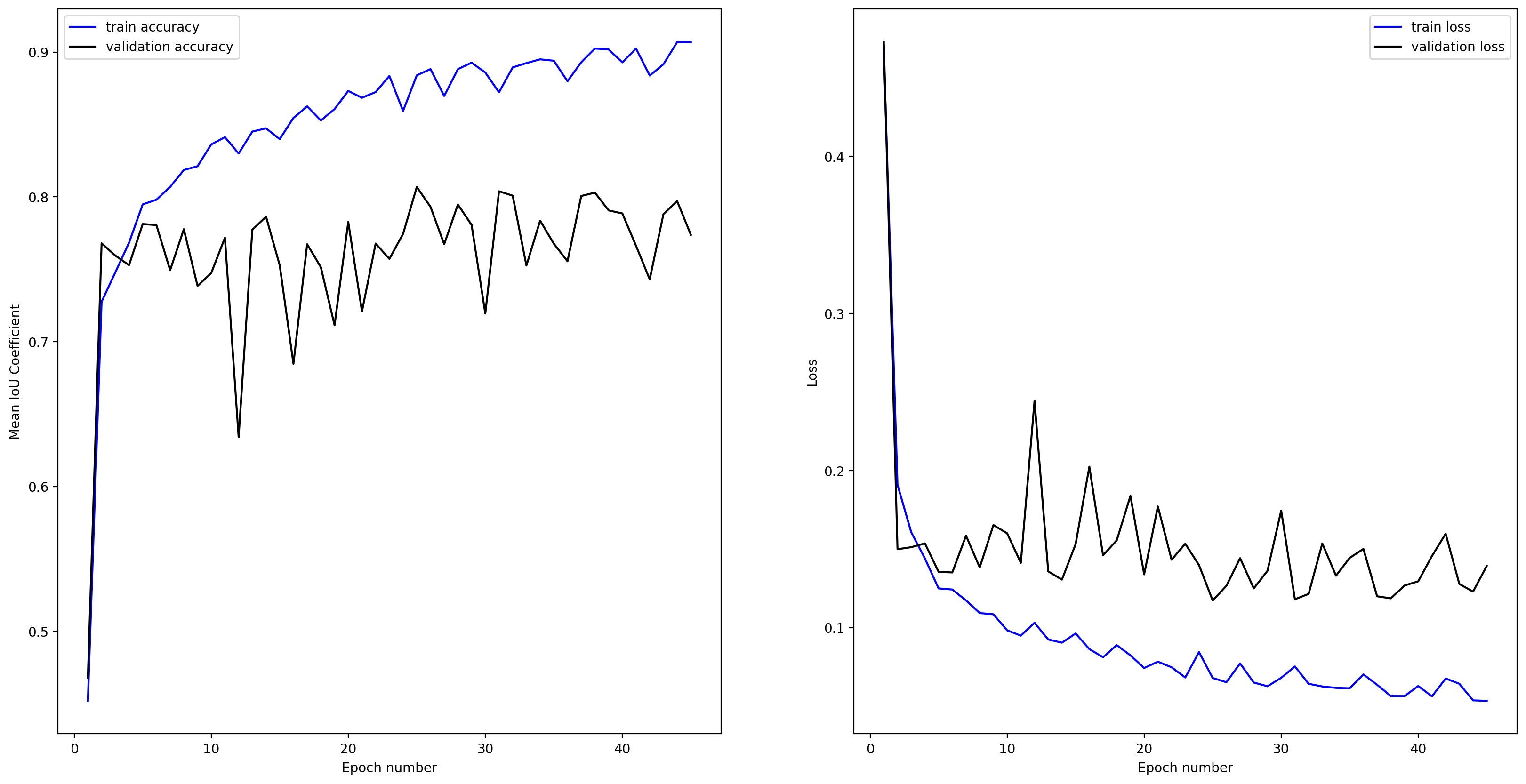
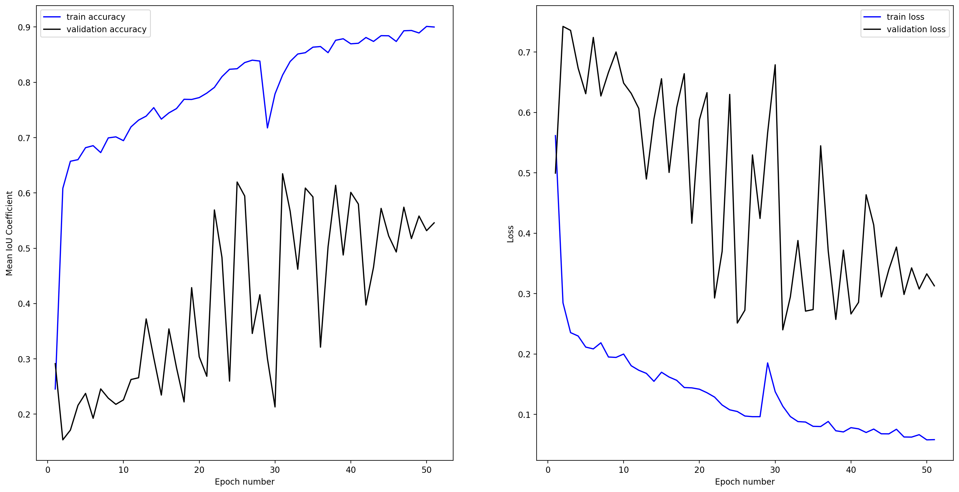
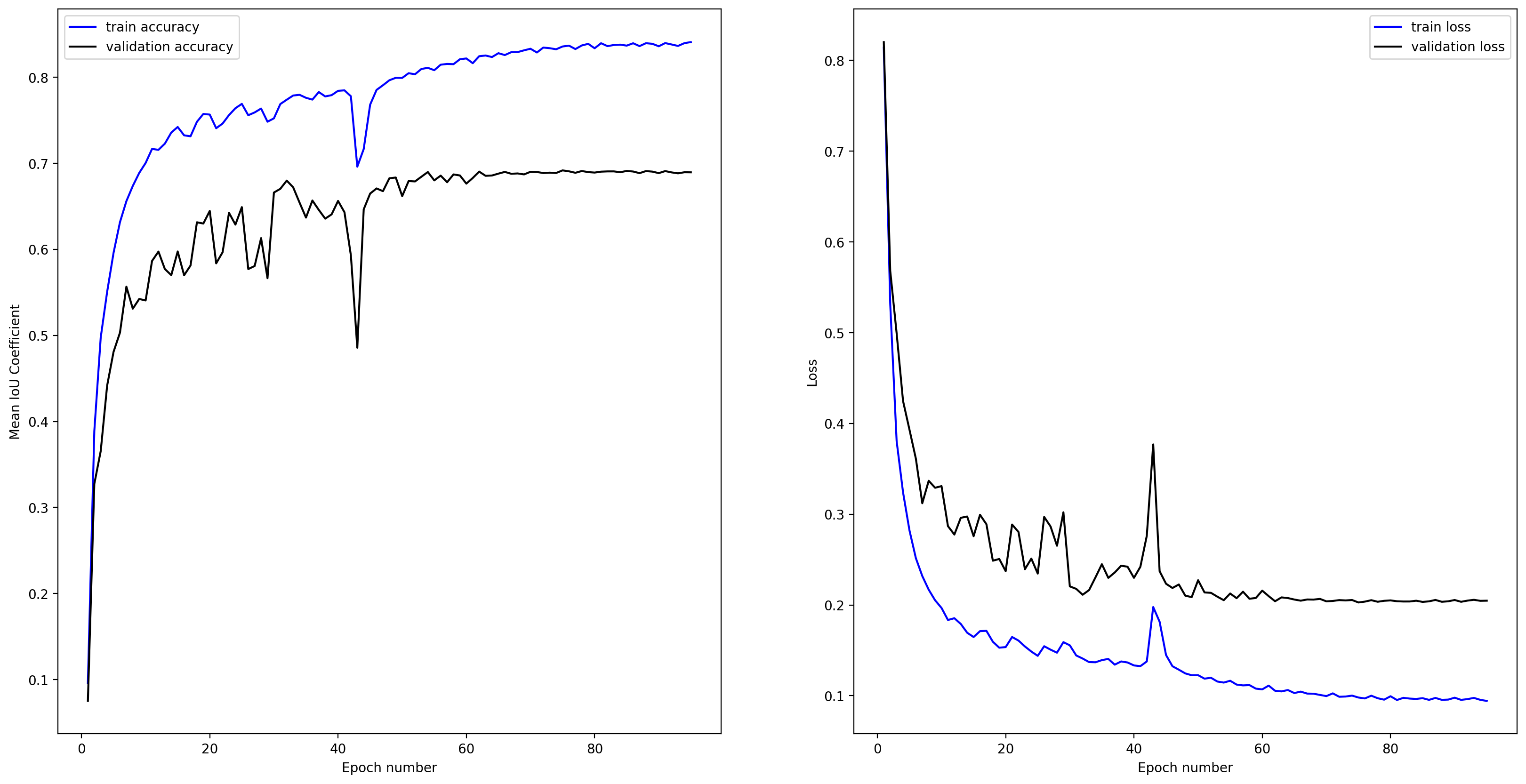
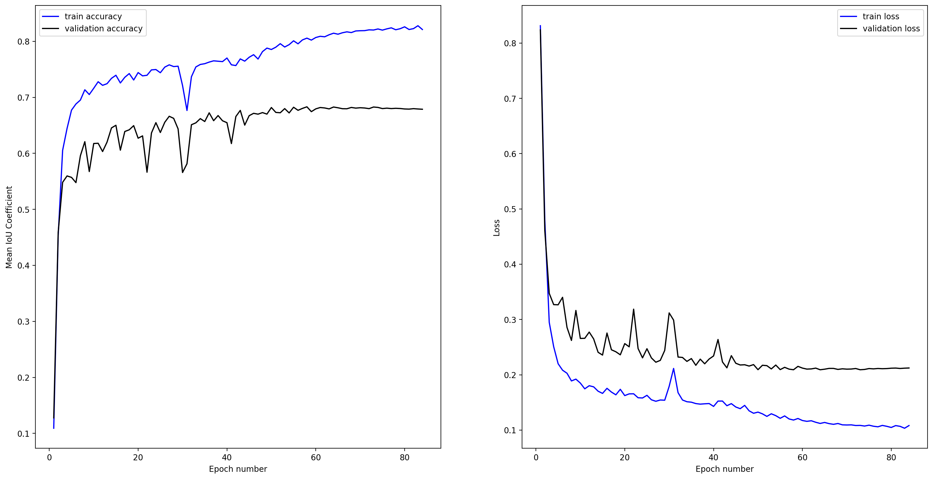
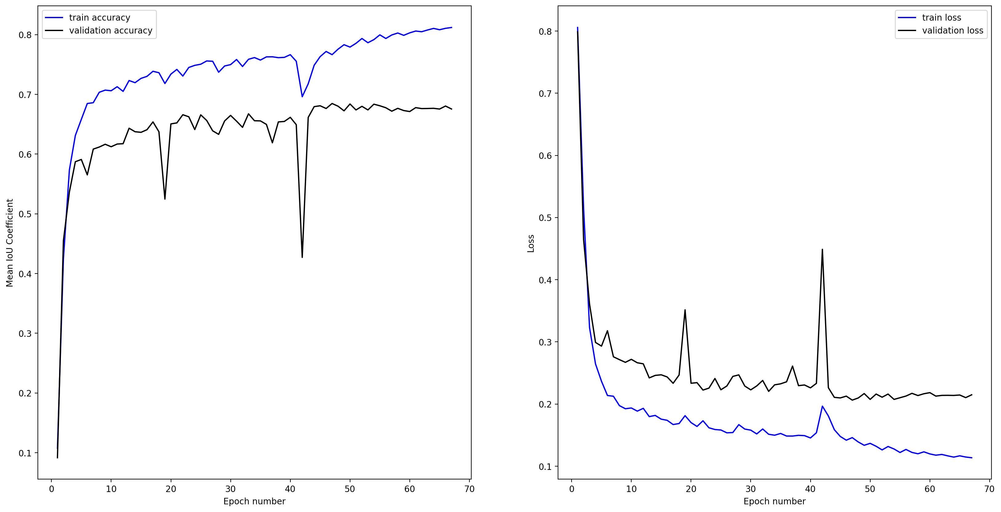
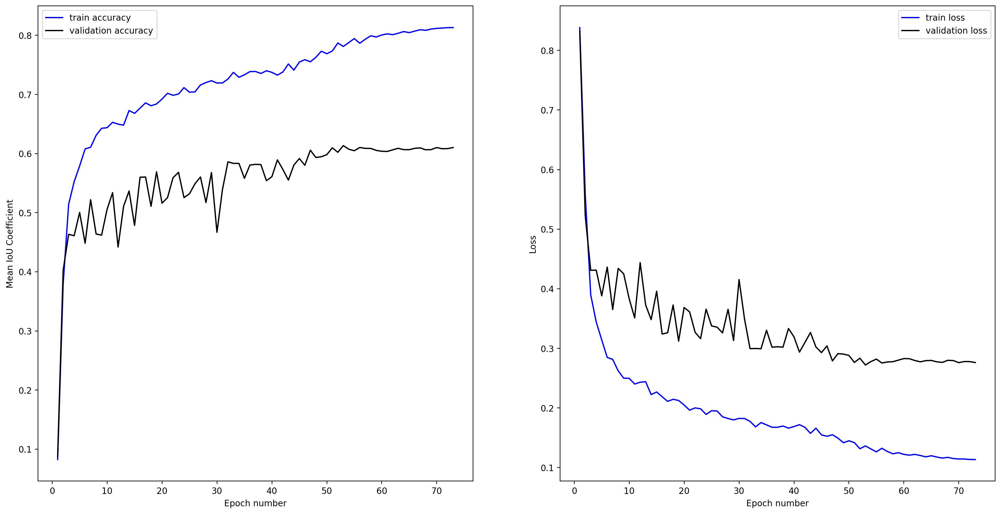
Training curve for the best model:
Some example validation outputs:


- Zenodo release: https://zenodo.org/record/7448390
- model citation: Buscombe, Daniel. (2022). Doodleverse/Segmentation Zoo Res-UNet models for 2-class (water, other) segmentation of Sentinel-2 and Landsat-7/8 5-band (RGB+NIR+SWIR) images of coasts. (v1.0) [Data set]. Zenodo. https://doi.org/10.5281/zenodo.7448390
- segmentation zoo model name:
sat_5band_2class_7448390
Training curve for the best model:
Some example validation outputs:


- Zenodo release: https://zenodo.org/record/7557072
- model citation: Buscombe, Daniel. (2023). Doodleverse/Segmentation Zoo Res-UNet models for 2-class (water, other) segmentation of Sentinel-2 and Landsat-7/8 1-band NDWI images of coasts. (v1.0) [Data set]. Zenodo. https://doi.org/10.5281/zenodo.7557072
- segmentation zoo model name:
sat_NDWI_2class_7557072
Training curve for the best model:
Some example validation outputs:


- Zenodo release: https://zenodo.org/record/7557080
- model citation: Buscombe, Daniel. (2023). Doodleverse/Segmentation Zoo Res-UNet models for 2-class (water, other) segmentation of Sentinel-2 and Landsat-7/8 1-band MNDWI images of coasts. (v1.0) [Data set]. Zenodo. https://doi.org/10.5281/zenodo.7557080
- segmentation zoo model name:
sat_MNDWI_2class_7557080
Training curve for the best model:
Some example validation outputs:


- A dataset of high resolution (cm - m) oblique aerial imagery, labeled according to the following classes:
- Water
- Whitewater
- Sediment
- Other
- dataset: https://zenodo.org/record/7335647#.Y_fk6IDMLRY
- dataset citation: Buscombe, Daniel, Goldstein, Evan, Bernier, Julie, Bosse, Stephen, Colacicco, Rosa, Corak, Nick, Fitzpatrick, Sharon, del Jesús González Guillén, Anais, Ku, Venus, Paprocki, Julie, Platt, Lindsay, Steele, Bethel, Wright, Kyle, & Yasin, Brandon. (2022). Images and 4-class labels for semantic segmentation of Sentinel-2 and Landsat RGB satellite images of coasts (water, whitewater, sediment, other) (v1.0) [Data set]. Zenodo. https://doi.org/10.5281/zenodo.7335647


- Zenodo release: https://zenodo.org/record/6950472
- model citation: Buscombe, Daniel. (2022). Doodleverse/Segmentation Zoo Res-UNet models for 4-class (water, whitewater, sediment and other) segmentation of Sentinel-2 and Landsat-7/8 3-band (RGB) images of coasts. (v1.0) [Data set]. Zenodo. https://doi.org/10.5281/zenodo.6950472
- segmentation zoo model name:
sat_RGB_4class_6950472
Training curve for the best model:
Some example validation outputs:


- Zenodo release: https://zenodo.org/record/7344606
- model citation: Buscombe, Daniel. (2022). Doodleverse/Segmentation Zoo Res-UNet models for 4-class (water, whitewater, sediment and other) segmentation of Sentinel-2 and Landsat-7/8 5-band (RGB+NIR+SWIR) images of coasts. (v1.0) [Data set]. Zenodo. https://doi.org/10.5281/zenodo.7344606
- segmentation zoo model name:
sat_5band_4class_7344606
Training curve for the best model:
Some example validation outputs:


- Zenodo release: https://zenodo.org/record/7358284
- model citation: Buscombe, Daniel. (2022). Doodleverse/Segmentation Zoo Res-UNet models for 4-class (water, whitewater, sediment and other) segmentation of Sentinel-2 and Landsat-7/8 7-band (RGB+NIR+SWIR+NDWI+MNDWI) images of coasts. [Data set]. Zenodo. https://doi.org/10.5281/zenodo.7358284
- segmentation zoo model name:
sat_7band_4class_7358284
Training curve for the best model:
Some example validation outputs:


- Zenodo release: https://zenodo.org/record/7352859
- model citation: Buscombe, Daniel. (2022). Doodleverse/Segmentation Zoo Res-UNet models for 4-class (water, whitewater, sediment and other) segmentation of Sentinel-2 and Landsat-7/8 1-band NDWI images of coasts. (v1.0) [Data set]. Zenodo. https://doi.org/10.5281/zenodo.7352859
- segmentation zoo model name:
sat_NDWI_4class_7352859
Training curve for the best model:
Some example validation outputs:


- Zenodo release: https://zenodo.org/record/7352850
- model citation: Buscombe, Daniel. (2022). Doodleverse/Segmentation Zoo Res-UNet models for 4-class (water, whitewater, sediment and other) segmentation of Sentinel-2 and Landsat-7/8 1-band MNDWI images of coasts. (v1.0) [Data set]. Zenodo. https://doi.org/10.5281/zenodo.7352850
- segmentation zoo model name:
sat_MNDWI_4class_7352850
Training curve for the best model:

Some example validation outputs:


