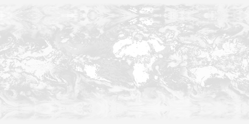
This project provides free, near real-time, high resolution cloud maps of the whole Earth. You can use them for whatever you like, including as cloud textures in 3D modelling in software like Blender or Xplanet, or in 2D graphics.
You can see them in use on my 3D ISS tracker.
Here's the latest image:
TL;DR: If you need a high-res greyscale almost-live cloud texture map, use this URL:
https://clouds.matteason.co.uk/images/8192x4096/clouds.jpg
Other formats and resolutions are shown below.
If you have any feedback you can raise an issue, start a discussion or tweet me (@MattEason)
If you find this project useful and you're feeling spendy, you can support me on Ko-Fi:
Images are updated eight times a day, every three hours, and pushed to clouds.matteason.co.uk. If you configure your software to
use https://clouds.matteason.co.uk/images/[RESOLUTION]/[FILENAME] you'll always stay up-to-date.
CORS is enabled, so you can use the latest daily images directly in JavaScript - for example, in a three.js TextureLoader.
I can't guarantee the freshness or quality of images; source data may not be available, or may be temporarily degraded.
The following images are created every three hours. All images are available in four resolutions: 8192x4096, 4096x2048, 2048x1024 or 1024x512.
The images shown are the latest images available.
The cloud map overlaid on NASA's The Blue Marble: Land Surface, Ocean Color and Sea Ice image.
Earth with clouds (day) image URLs (all resolutions)
These URLs are for the latest images:A greyscale cloud map. Layer this over an image of Earth (and set the blending mode to 'screen' if necessary).
Cloud map image URLs (all resolutions)
These URLs are for the latest images:The same as above, but as a PNG with alpha transparency (the preview above may not be visible if you use light mode).
Cloud map (alpha) image URLs (all resolutions)
These URLs are for the latest images:The cloud map overlaid on NASA's Earth at Night image. You can combine this with the day image using some fancy shader magic to create day/night transitions between this and the day texture:
Earth with clouds (night) image URLs (all resolutions)
These URLs are for the latest images:You can use this specular map to make your model more realistic by only showing specular highlights on bodies of water:
Specular image URLs (all resolutions)
These URLs are for the latest images:The generated images have some limitations due to the source data.
The satellites do not capture the polar regions. To compensate for this, the top and bottom of the image are mirrored to cover the gap. These regions aren't very visible on 3D images anyway, and most of the area is covered by the ice caps which makes the clouds even less visible.
Occasionally, the satellites capturing the source data will miss some regions. These areas will appear as square-ish holes without clouds.
The cloud data used for these images is provided by EUMETSAT. You must provide the following attribution to them, per their licensing:
Contains modified EUMETSAT data
The Earth image is provided by NASA. Because it's a work of the US government, it's in the public domain.
I've also released the code and images in this repository into the public domain using the CC0 1.0 Universal licence.
I'd appreciate an attribution if you use the code or images, but it's not necessary. I'd love to know how you're using this project - get in touch on X/Twitter @MattEason or email [email protected].
Images are processed with the help of the excellent JIMP image manipulation library.
If you find this project useful, you can support me on Ko-Fi:


