PySAL_ is an open source cross-platform library of spatial analysis functions written in Python. It is intended to support the development of high level applications for spatial analysis.

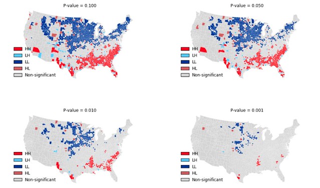
Above: Local Indicators of Spatial Association for Homicide Rates in US Counties 1990.
- pysal.cg Computational geometry
- pysal.contrib Contributed modules
- pysal.core Core data structures and IO
- pysal.esda Exploratory spatial data analysis
- pysal.examples Data sets
- pysal.inequality Spatial inequality analysis
- pysal.network Spatial analysis on networks
- pysal.region Spatially constrained clustering
- pysal.spatial_dynamics Spatial dynamics
- pysal.spreg Spatial econometrics and diagnostics
- pysal.weights Spatial weights
PySAL can be installed using pip:
$ pip install pysalPySAL is also available through Anaconda and Enthought Canopy.
For help on using PySAL, check out the following resources:
PySAL development is hosted on github.
Discussions of development occurs on the developer list as well as gitter.
If you are interested in contributing to PySAL please see our development guidelines.
To search for or report bugs, please see PySAL's issues.
See the file "LICENSE.txt" for information on the history of this software, terms & conditions for usage, and a DISCLAIMER OF ALL WARRANTIES.