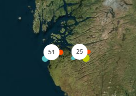
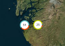
While upgrading the original codebase an abstraction was created & the library was restructured to allow for easier integration with other libraries. This library is now a full clustering library that can be used with other geospatial algorithms.
Example 1: 150 000 randomly moving markers.
The library is designed for large datasets or live situations. The memory consumption is kept low and the library is fast on mobile devices, thanks to a new algorithm inspired by collision detection in physical engines.
TODO:
- Simplify the weight system
- Simplify the category system
=================================
You can specify the weight of each marker.
For example, you may want to add more importance to a marker representing an incident, than a marker representing a tweet.
You can specify a category for the markers. Then a small object representing the number of markers for each category is attached to the clusters. This way, you can create cluster icons adapted to their content.
The size of a cluster can be adjusted on the fly (Example)
The markers can be filtered easily with no performance cost.
<!--Include leaflet-->
    <link rel="stylesheet" href="https://unpkg.com/[email protected]/dist/leaflet.css"
      integrity="sha256-p4NxAoJBhIIN+hmNHrzRCf9tD/miZyoHS5obTRR9BMY=" crossorigin=""/>
    <script src="https://unpkg.com/[email protected]/dist/leaflet.js"
        integrity="sha256-20nQCchB9co0qIjJZRGuk2/Z9VM+kNiyxNV1lvTlZBo="
        crossorigin=""></script>

<!--Include leaflet-clustering-->
    <script src="dist/leaflet-clustering.mjs"></script>

<!--In Body -->

<!-- Leaflet map object -->
<div id="map"></div>

<script>
    let LeafletAdapter = LeafletClustering.LeafletAdapter;
    let ClusterMarker = LeafletClustering.ClusterMarker;

//     On document loaded, for example
    document.addEventListener('DOMContentLoaded',(event)=>{
        // Setup your map object
        const map = L.map("map", {
            attributionControl: false,
            zoomControl: false
        }).setView(new L.LatLng(59.911111, 10.752778), 8);

        // Add a tile layer
        L.tileLayer('https://{s}.tile.osm.org/{z}/{x}/{y}.png', {
            detectRetina: true,
            maxNativeZoom: 17
        }).addTo(map);

        // Initialize your implementation. e.g: LeafletAdapter
        const leafletView = new LeafletAdapter();
        leafletView.onAdd(map);
        console.log('LeafletAdapter Loaded & added to map');
        const size = 150000;
        const markers = []; //Array of ClusterMarker

        console.log('Adding Markers');
        for (let i = 0; i < size; ++i) {
            const marker = new ClusterMarker(
                    59.91111 + (Math.random() - 0.5) * Math.random() * 0.00001 * size,
                    10.752778 + (Math.random() - 0.5) * Math.random() * 0.00002 * size
            );

            // Local storage for markers here.
            markers.push(marker);

            // Handle your markers registration through our layer now.
            leafletView.RegisterMarker(marker);
        }

        console.log(`Added ${size} Markers to map.`);
        console.log('Processing View');

        //When anything changes, process the view here.
        leafletView.ProcessView();

        // Interval assigned to simulate moving markers to show for the example
        window.setInterval(() => {
            for (let i = 0; i < size / 2; ++i) {
                const coef = i < size / 8 ? 10 : 1;
                markers[i].position = {
                    ...markers[i].position,
                    lat: markers[i].position.lat + (Math.random() - 0.5) * 0.00001 * coef,
                    lng: markers[i].position.lng + (Math.random() - 0.5) * 0.00002 * coef
                };
                // const ll = markers[i].position;
                // ll.lat += (Math.random() - 0.5) * 0.00001 * coef;
                // ll.lng += (Math.random() - 0.5) * 0.00002 * coef;
            }

            leafletView.ProcessView();
        }, 3000);
    });


</script>bun add @wogwonsociety/leaflet-clustering
import { PruneCluster, LeafletAdapter } from '@wogwon/leaflet-clustering';// Prune cluster
var pruneCluster = new LeafletAdapter();
// Provide a custom clusterHandler
// var adapter = new LeafletAdapter({clusterHandler: new CustomClusterHandler()});
...
var marker = new VirtualMarker(59.8717, 11.1909);
pruneCluster.RegisterMarker(marker);
...
leafletMap.addLayer(pruneCluster);LeafletAdapter([size](#set - the - clustering - size), margin);You can specify the size and margin which affect when your clusters and markers will be merged.
size defaults to 120 and margin to 20.
marker.Move(lat, lng);// Remove all the markers
pruneCluster.RemoveMarkers();
// Remove a list of markers
pruneCluster.RemoveMarkers([markerA,markerB,...]);The category can be a number or a string, but in order to minimize the performance cost, it is recommended to use numbers between 0 and 7.
marker.category = 5;marker.weight = 4;marker.filtered = true|false;You can specify a number indicating the area of the cluster. Higher number means more markers "merged". (Example)
pruneCluster.Cluster.Size = 87;Must be called when ANY changes are made.
pruneCluster.ProcessView();Each marker has a data object where you can specify your data.
marker.data.name = 'Roger';
marker.data.ID = '76ez';You can attach to the markers an icon object and a popup content
marker.data.icon = L.icon(...);  // See http://leafletjs.com/reference.html#icon
marker.data.popup = 'Popup content';If you have a lot of markers, you can create the icons and popups on the fly in order to improve their performance.
function createIcon(data, category) {
    return L.icon(...);
}

...

marker.data.icon = createIcon;
You can also override the PreapareLeafletMarker method. You can apply listeners to the markers here.
pruneCluster.PrepareLeafletMarker = function(leafletMarker, data) {
    leafletMarker.setIcon(/*... */); // See http://leafletjs.com/reference.html#icon
    //listeners can be applied to markers in this function
    leafletMarker.on('click', function(){
    //do click event logic here
    });
    // A popup can already be attached to the marker
    // bindPopup can override it, but it's faster to update the content instead
    if (leafletMarker.getPopup()) {
        leafletMarker.setPopupContent(data.name);
    } else {
        leafletMarker.bindPopup(data.name);
    }
};pruneCluster.BuildLeafletClusterIcon = function(cluster) {
var population = cluster.population, // the number of markers inside the cluster
stats = cluster.stats; // if you have categories on your markers
// If you want list of markers inside the cluster
// (you must enable the option using PruneCluster.Cluster.ENABLE_MARKERS_LIST = true)
var markers = cluster.GetClusterMarkers()
...
return icon; // L.Icon object (See http://leafletjs.com/reference.html#icon);
};To listen to events on the cluster, you will need to override the BuildLeafletCluster method. A click event is already specified on m, but you can add other events like mouseover, mouseout, etc. Any events that a Leaflet marker supports, the cluster also supports, since it is just a modified marker. A full list of events can be found here.
Below is an example of how to implement mouseover and mousedown for the cluster, but any events can be used in place of those.
pruneCluster.BuildLeafletCluster = function(cluster, position) {
      var m = new L.Marker(position, {
        icon: pruneCluster.BuildLeafletClusterIcon(cluster)
      });

      m.on('click', function() {
        // Compute the  cluster bounds (it's slow : O(n))
        var markersArea = pruneCluster.Cluster.FindMarkersInArea(cluster.bounds);
        var b = pruneCluster.Cluster.ComputeBounds(markersArea);

        if (b) {
          var bounds = new L.LatLngBounds(
            new L.LatLng(b.minLat, b.maxLng),
            new L.LatLng(b.maxLat, b.minLng));

          var zoomLevelBefore = pruneCluster._map.getZoom();
          var zoomLevelAfter = pruneCluster._map.getBoundsZoom(bounds, false, new L.Point(20, 20, null));

          // If the zoom level doesn't change
          if (zoomLevelAfter === zoomLevelBefore) {
            // Send an event for the LeafletSpiderfier
            pruneCluster._map.fire('overlappingmarkers', {
              cluster: pruneCluster,
              markers: markersArea,
              center: m.getLatLng(),
              marker: m
            });

            pruneCluster._map.setView(position, zoomLevelAfter);
          }
          else {
            pruneCluster._map.fitBounds(bounds);
          }
        }
      });
      m.on('mouseover', function() {
        //do mouseover stuff here
      });
      m.on('mouseout', function() {
        //do mouseout stuff here
      });

      return m;
    };
};Marker icon redrawing with a flag:
marker.data.forceIconRedraw = true;

...

pruneCluster.ProcessView();
Redraw all the icons:
pruneCluster.RedrawIcons();This library was developed in context of the BRIDGE project. It is now supported by the community and we thank the contributors.
Originally a fork of PruneCluster, this library provides an alternative to the default leaflet marker clustering using a 'sweep & prune' algorithm.
The source code of this library is licensed under the MIT License.


